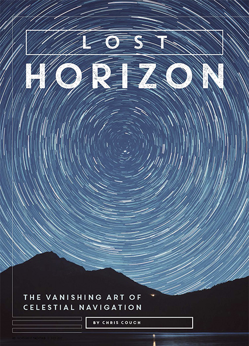
Lost Horizon
by Chris Couch
July 2017 • North West Yachting
How a nearly century-old concept might transform sailing
The Vanishing Art of Celestial Navigation
From the time mankind began our travels upon this planet, we observed and made note of our surroundings to aid us in our journeys.
There continues to be emerging evidence that over 15,000 years ago, during the last ice age, peoples from Europe followed the edge of the ice around the North Atlantic to the North American continent. These people later joined up with others who came from the west to become the Clovis people. There is also evidence that ancient Japanese peoples landed on the west coast of South America and that the Polynesians landed on the West Coast of the United States. The Phoenicians and then the Vikings landed on the East Coast of North America. All this occurred thousands of years before Columbus, and probably just the tip of the “History of Us” iceberg. It is certain that on a planet covered mostly by water, our legacy is tied to the sea.
The first elements of navigation as we know it probably started in the Mediterranean with trade between emerging civilizations. The lighthouse and many shore aids to navigation owe their beginnings to this area. One of the earliest well-recorded voyages was by Greek astronomer and navigator Pytheas. Sometime between the years 350 and 300 BC, he sailed from a Mediterranean port to England and then on to Scotland, the Norwegian fiords, and northwest Germany.
What makes this so significant is that Pytheas and other intrepid mariners of the time accomplished this with no compass, no sextant, and no timepieces. Although basic piloting along the coasts was used, there would have been many times when these ancient mariners lost sight of land. This is where their unique observations of the winds, seas, and stars allowed them safe return to port. For any person who has an interest in marine navigation and its history, The American Practical Navigator Volume I by Nathaniel Bowditch is highly recommended. Since it was first published in 1802, The American Practical Navigator has been the leading navigational text and reference.
I started my marine career back in 1976 when I went into the United States Coast Guard right out of high school. I consider myself very fortunate to have spent the first part of my marine career in the time before computers and GPS. When I first started to navigate ships, we used visual bearings. Using a device called a pylorus, we would sight a charted object and observe the compass bearing to it. We would then plot the bearing on a paper chart, which would become one line of position. We also used radar ranges from analog radar, again plotting those ranges, usually from a charted land mass. Radio beacons were tuned in using a radio direction finder to, once again, plot those bearings on a chart for a line of position. Using this variety of visual, radar, and radio bearings, we would get a “fi x” or position. During that time for offshore navigation, we had the first short-range, landbased radio navigation system called LORAN-A, the fi rst long-range, landbased radio system called OMEGA, and the first satellite navigation system called the Transit System. These first systems were for offshore only and had accuracy measured in miles. By the late 1970s, the next-generation land-based radio navigation system came online and it was called LORAN-C. It was accurate down to one half-mile but had good repeatability.
Because of the inherent inaccuracies of these early systems, we also continued to use celestial navigation for offshore navigation and positioning offshore weather and research buoys. Yes, celestial navigation was still being used as a regular navigation tool up through the late 1970s. I wouldn’t see the first GPS receiver made by Magellan until 1985, still several years before the system was up and fully running. Just in my lifetime, we have gone from the simple radio direction finder to GPS; from large clumsy paper charts to computer-driven chart plotters to having the whole thing on your smart phone or iPad. We have gone from looking out at the world around us to staring inside at our screens. I have witnessed the vanishing of our navigational arts.
It is probably a bit ironic that one of the most reliable tools we have in our pilot house is also the least used and most neglected: the magnetic compass. A needle thrust through a straw and floated in a container of water is what describes the earliest “known” compass. When the magnetic compass was first used is unknown and there is very little to substantiate where it came from, although it’s widely believed that the Chinese developed it around 1,000 A.D. Today, the magnetic compass is our only non-electronic instrument to maintain directional orientation and remains the one instrument you can rely on when all else fails.
The practice of visual observation to fix your position and follow your intended route is called “piloting” and still remains the fundamental basis of navigation. Piloting is the practice of correlating your surroundings with what you see on your chart. You then use this observation and correlation to fi x and continually monitor your approximate position relative to the chart and safe water. With today’s technology however, I see too many boaters staring down at their chart plotters and not looking outside and observing the world around them. Practice identifying the buoys, lights, and landmarks that you see with what is on your chart and your radar. The more you do this, the more proficient a mariner and navigator you will become.
Before GPS and chart plotters, we used paper charts upon which we would physically plot our observed lines of position to create a navigational fix. A “fix” is the intersection of at least three Lines of Position (LOP). A Line of Position can be a bearing to a charted object, or a radar range to a point of land or the beach. In LORAN-C, it was the time difference between a “master” and “slave” stations. In GPS, it is the time the signal takes to travel from the satellite to your receiver.
Because there could be several hours between your plotted fixes, dead reckoning was used to predict your approximate position into the future using your heading steered, estimated speed, and time. Dead reckoning was undoubtedly used the first time the earliest mariners sailed beyond the sight of land and up until the mid 1960s when OMEGA and LORAN-A became widely used.
Since the early 1990s, we have pretty much been staring at our chart plotters. But from the beginning of modern people’s presence on this planet, we have looked to the sky to help find our way. Since that beginning and to this day, in a world where everything keeps moving and changing, there has been one object that has remained a fixed, steadfast beacon for us to follow. Positioned directly above our geographical North Pole, it is the North Star.
Because of its fixed position in the sky, the North Star, or Polaris, was probably the fi rst star used for marine navigation. Because Polaris happens to sit directly above the geographical North Pole, the observed angle (or height observed) between it and the visible horizon is also your latitude. The ability to determine latitude at sea has been around for thousands of years.
When Polaris was first employed to determine latitude is not known. By the time of Columbus, some navigators utilized a specialized angle measuring instrument called the nocturnal to determine latitude. By the late 1500s, the nocturnal became more widespread.
The second celestial body important to navigation was the sun. Since before the Common Era (BC), astronomers used daily observations to calculate the sun’s declination (its annual movement north and south of the equator). By the 15th century, experienced seamen were using the sun to determine their latitude at sea within a few degrees. This is called local apparent noon. When the sun is at the highest point in the sky, that is your local apparent noon (LAN) or zenith. At that moment, the sun’s angle to the horizon can be observed (height observed or HO) and then by applying its declination at that moment, your latitude can be determined.
Up until a mere 250 years ago, the mariner could only accurately determine latitude on the open sea. The only way to cross oceans from point A to point B was to sail north or south to the latitude of your destination and then east or west until you arrived. This was called parallel sailing. The mariner had no way of accurately determining how far they had sailed east or west other than dead reckoning. Because of the inability to accurately measure speed, estimates could be off by days or even weeks. The search to determine longitude had begun. Determining longitude requires knowing how far east or west you are from a known point, such as the prime meridian, to where the sun is positioned. To know the time the sun is at the prime meridian and the time where you are presently, time must be accurately measured to the second. An accurate and reliable time piece, or chronometer, was needed.
To encourage the development of this much needed way to keep time at sea, the Royal Navy and British Merchant Marine created The Board of Longitude in 1714 that offered a reward to anyone who could create a serviceable chronometer. The first crude timepiece was built in 1660, but it wouldn’t be until 1766, over 100 years later, that an accurate and reliable chronometer would be accepted and the prize awarded. This timepiece would become the basis of all chronometers for the next 200 plus years. With accurate time now available, point to point celestial navigation at sea was a possibility.
Even though accurate time was now available, it wouldn’t be until 1837 or another 70 years before the celestial navigation that we are familiar with today would start being used. I remember back in the mid 1970s as a novice navigator, one of my daily duties was to wind the chronometer promptly at noon and record its deviation. Of course, today we have incredibly accurate time everywhere we look. The time display on your GPS is set by the Atomic Clock in Boulder, Colorado.
At any moment in time, any celestial body (i.e., the sun, moon, planets, and stars) is directly overhead somewhere on the earth. Let’s use the sun as an example: at any moment in time, the sun is directly overhead (90 degrees) somewhere on the face of the planet. This spot is called its geographic position. This position can be described by the sun’s declination (similar to latitude) and by its Greenwich Hour Angle (GHA), which is similar to longitude. If we were standing directly under the sun at the exact moment it was 90 degrees overhead, that would also be our position on the earth in latitude and longitude.
Declination is the position of the sun, north or south of the Equator, and equates to latitude. The earth is tilted on its axis at 23.5 degrees. As it orbits the sun, the sun’s geographic position to us earthlings moves north and south. It is at its furthest north the first day of summer and furthest south the first day of winter. It is directly over the Equator or zero declination on the spring and fall equinoxes. GHA is the sun’s position west of the prime meridian at Greenwich, England, and equates to longitude. GHA will move 360 degrees every 24 hours.
The geographic position of the sun, moon, Venus, Mars, Saturn, Jupiter, and the navigational stars can all be described with declination (latitude) and GHA (longitude). Over hundreds of years and tens of thousands of observations, the tables containing all this information have been developed. Each year a nautical almanac is published with these tables, providing the necessary information to process your celestial navigation observation.
Let’s presume that the sun is directly overhead. Its declination and GHA at that moment in time would be our position in latitude and longitude. In eality, it is unlikely we would happen to be so close to a celestial body’s geographic position. Let’s say our observation of the sun was 50 degrees above the horizon. The opposite angle would be 40 degrees. Each degree of arc is equal to 60 nautical miles, so 40 degrees times 60 nautical miles equals 2,400 nautical miles, meaning the distance from us to the sun’s geographical position is 2,400 miles. If you took a globe and scribbled a circle 2,400 nautical miles in diameter around the sun’s geographical position, that is called the circle of equal altitude. We are somewhere on that circle. That is one line of position.
In the early 1600s, a navigator named Pedro Nunes plotted circles of equal altitude on a globe to fi x his position. You can imagine the inherent inaccuracy of trying to do that. Just the width of the line he would draw would represent several miles. It wouldn’t be until nearly 1850, only 167 years ago, that a method would be developed to plot a small section of the circle of equal altitude on a regular navigational chart. This would be called the Altitude Intercept Method and is the method still in use today. Of course, now we have apps for your smart device that will do all of the calculations for you. You just plug in the height observed along with date, time, and your assumed position and it will spit out the line of position for you. For those who are truly interested in learning more about celestial navigation, I recommend the book the Naval Academy uses, Marine Navigation 2 Second Edition by Richard Hobbs. I have also published a book that will introduce you to the basics called The Lost Horizon that can be found on Compassheadingspublishing.com or at Amazon.com.
For good or bad, with constantly evolving technology, it has not taken us very long to bypass methods and practices that guided our voyages for millenia. From the beginning of our presence on this planet, we have looked to the sky to help find our way. The stars are what we are made of and where we came from. They will always be there to guide us.
Captain Chris Couch is a successful Pacific Northwest-based delivery captain who has been widely used by companies like Alexander Marine for the last 26 years. Couch enjoyed a 14-year career in the U.S. Coast Guard that took him around the country to the East Coast, Gulf, and West Coast on all kinds of vessels. He has been at the helm through the Panama Canal five times and for four transpacific crossings. His book, The Checklist, is enjoyed by and distributed to yachts owners and is a fantastic resource that covers just about everything relevant to a PNW Boater. You can buy The Checklist, check out his other publications, or contact him at compassheadings.com.
NWY